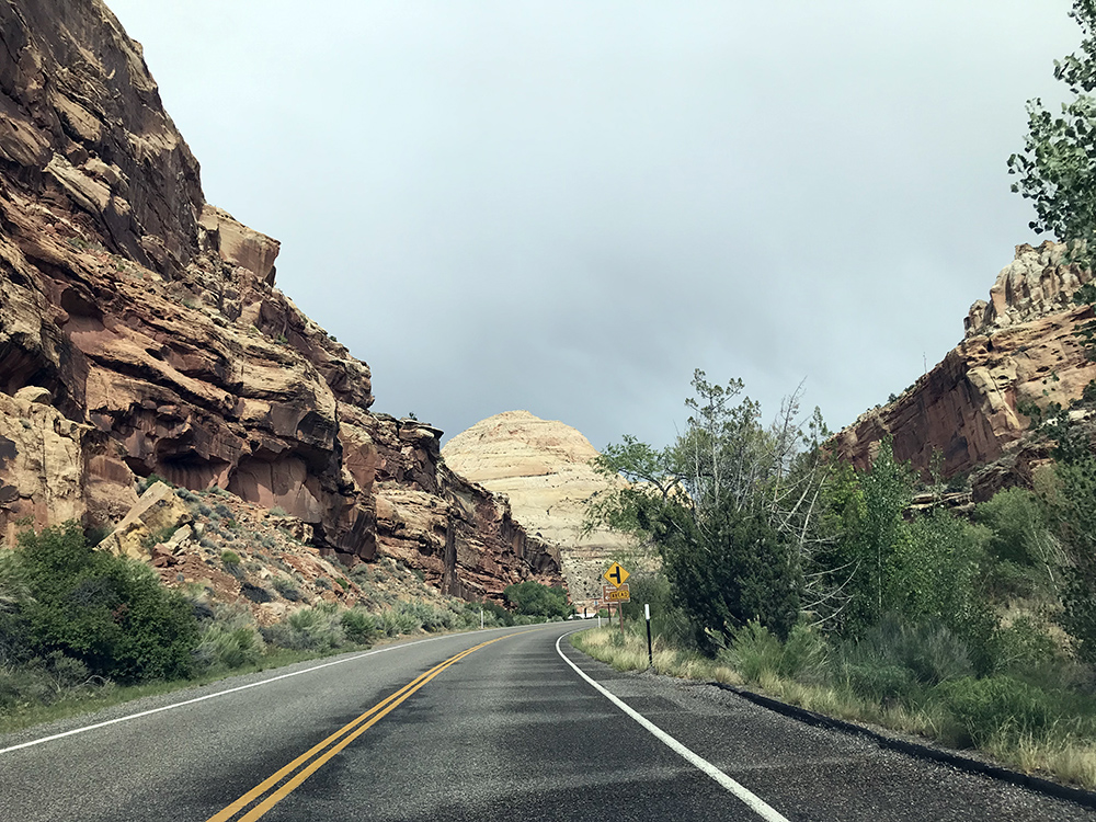
Off To Zion National Park
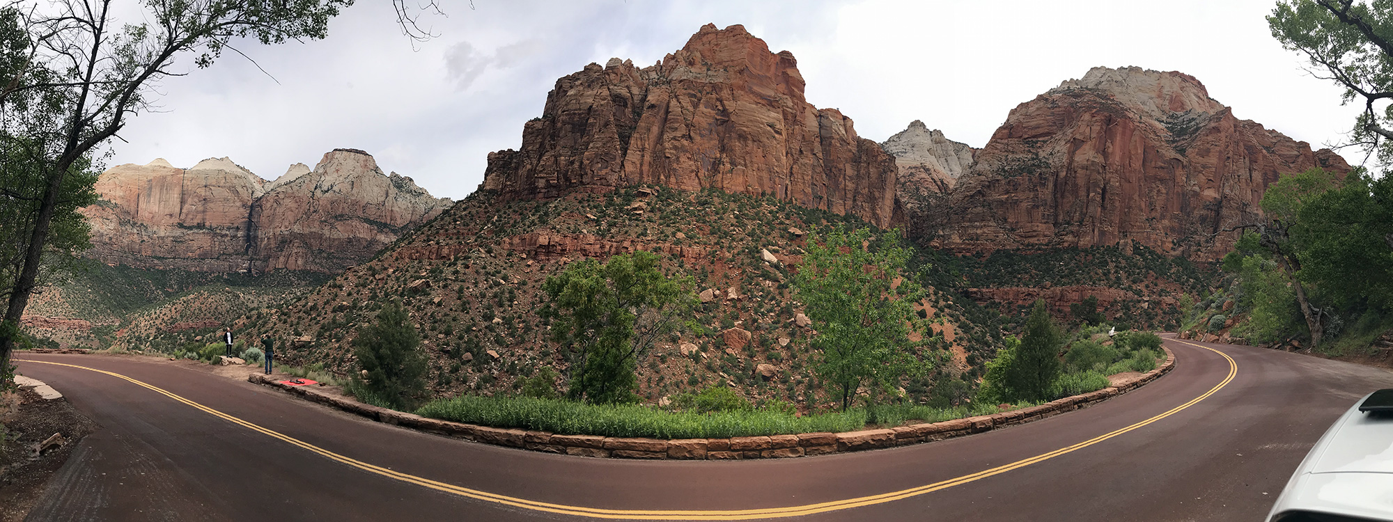
It took me a while to get packed-up and on the road this morning. Then, the drive to Zion National Park (ZNP) took longer than I’d expected it to. Unfortunately, this resulted in a crazy traffic situation and missing some beautiful weather in the early morning. ZNP was one of the most beautiful parks I visited on the trip, and I’m able to say that without hardly seeing any of it. My plan was to drive in, get a pin at the visitors center and get out, but my route took me through a long tunnel which required a long wait on both sides and the traffic and parking once I got into the heart of the canyon was a nightmare. Still, just getting to drive through the park was amazing.
Back to Bryce Canyon National Park
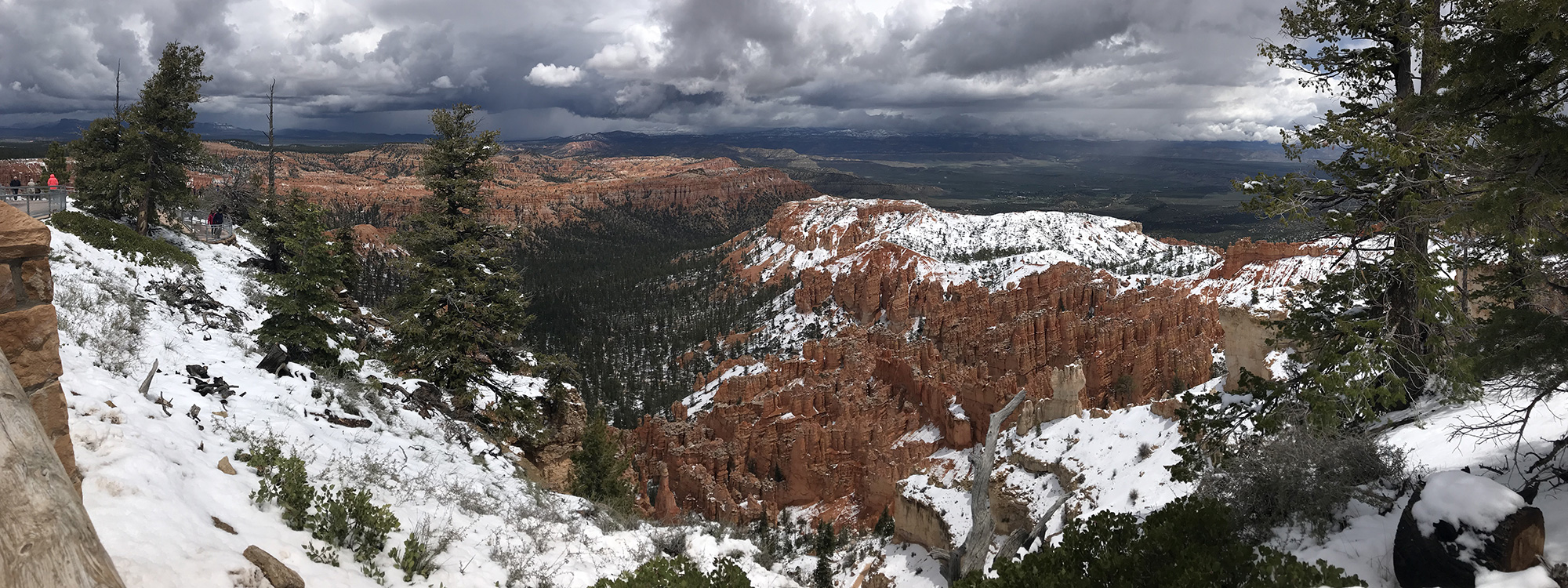
By the time I left ZNP and started heading towards Bryce Canyon National Park (BCNP), the clouds had moved-in and it began raining/snowing a bit. It was fun to return to Bryce and actually get to see the canyon. My obsession of hitting as many parks as possible on the trip was entertaining, but I admit that I felt lame picking-up a pin at BCNP without actually seeing its namesake.
While the canyon is beautiful and stunning, I don’t think it’s worth it if you only get to see it from the viewing areas. I’d planned on taking a hike through the canyon itself where you can get down in there among the hoodoos, but the trails were all closed due to the weather. All I was able to do was get a short walk from Sunset Point to Sunrise Point and back again. By then, the wet snowy mix was really coming down, so I headed off to my next destination.
Next Stop: Capitol Reef National Park
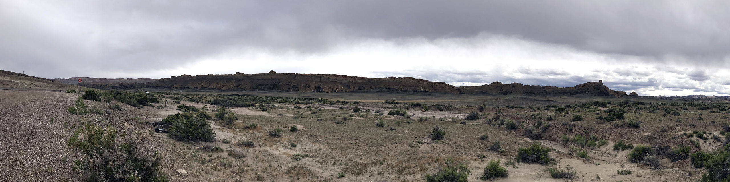
Looking at the map, I saw that there were a few different paths that I could take to get from BCNP to Capitol Reef National Park (CRNP). The weather had turned rather nasty, so I chose what I figured was the safest route for my vehicle which took me the long way around. Along the way I ran into and back out of horrible weather numerous times, which sucked because I preferred to drive around with my windows down capturing video of the world as it passed by.
CRNP is a massive park with distant and epic landscapes, which made me quickly fall in love with it, despite the aweful weather. It hadn’t occurred to me at the time, but I’d actually returned to the basic San Rafael Swell area that had struck me so hard on the trip west. More than specific geographical landmarks (like arches or waterfalls), it’s the vastness of the empty spaces in Utah that are bordered by mesas and plateaus that span for miles and miles that take my breath away. I could easily spend days just driving through the back roads of this area and be as happy as I could ever be.
The Long Drive Back To Civilization
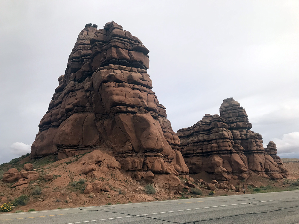
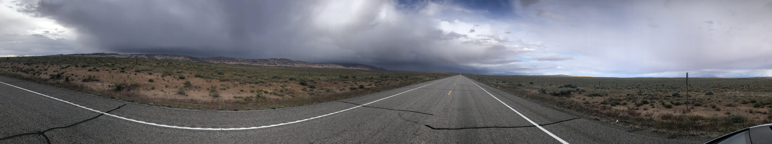
And driving long distances through the middle of nowhere is exactly what I got because there’s nothing between CRNP and Green River, Utah, which was my ultimate destination for the day. That’s unfair to say, though. The Cainville Badlands are insane in the blackness, and then you have Kathline Rock just sitting on the side of the road with nothing else for miles around it. But Route 24 from Hanksville up to Route 70 is nearly a straight shot. During the ride, I saw endless horizons with storm clouds to the west and sunshine to the east. It was fun to just stop in the middle of the road and get out of the car so I could really get a good look at it all.
Utah: BYOB
By the time I made it to Green River, all I wanted to do was unload and drink a few beers while I got the video and photos I shot organized. That’s when I learned that while gas stations sell beer, it’s all 3.2% beer. Yes, that means if you buy Miller High Life… it’s 3.2%. What about something like a relatively popular IPA what usually sits around 7%? Yeah, that’s also 3.2%! I don’t know how they do it, but they did it and I wasn’t sure on whether or not there were state stores, so I just bought a couple of large cans of watered down Budweiser because I knew I had whiskey that I could chase it with. It really didn’t matter because the day was long and I knew that tomorrow was going to be even longer, so I hit my bed relatively early and rather hard.
Image Gallery
- Zion National Park Zion Canyon's also not over-rated. I wish I'd had more time to hang-out here.
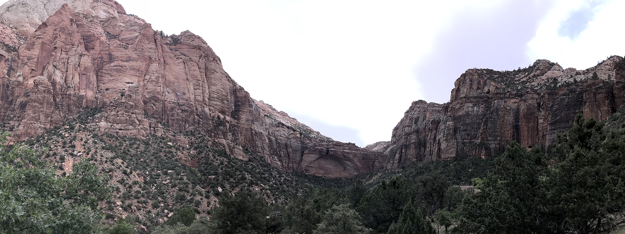
- Zion National Park: The Eye I thought that half circle in the center bottom of the picture looked like an eye.
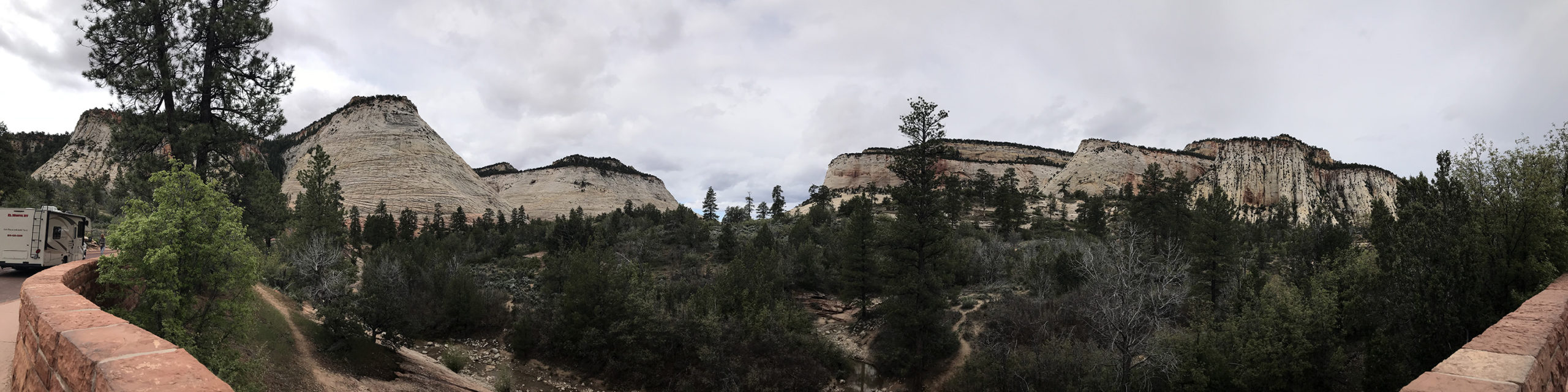
- Zion National Park: Checkerboard Mesa Checkerboard Mesa is on the left.
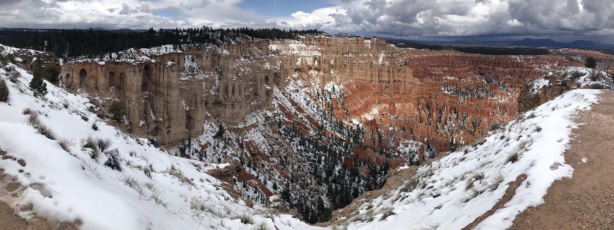
- Bryce Canyon National Park: Bryce Point
- Bryce Canyon National Park: Bryce Point
- Bryce Canyon National Park: Thor's Hammer Thor's Hammer is in the very center of the picture.
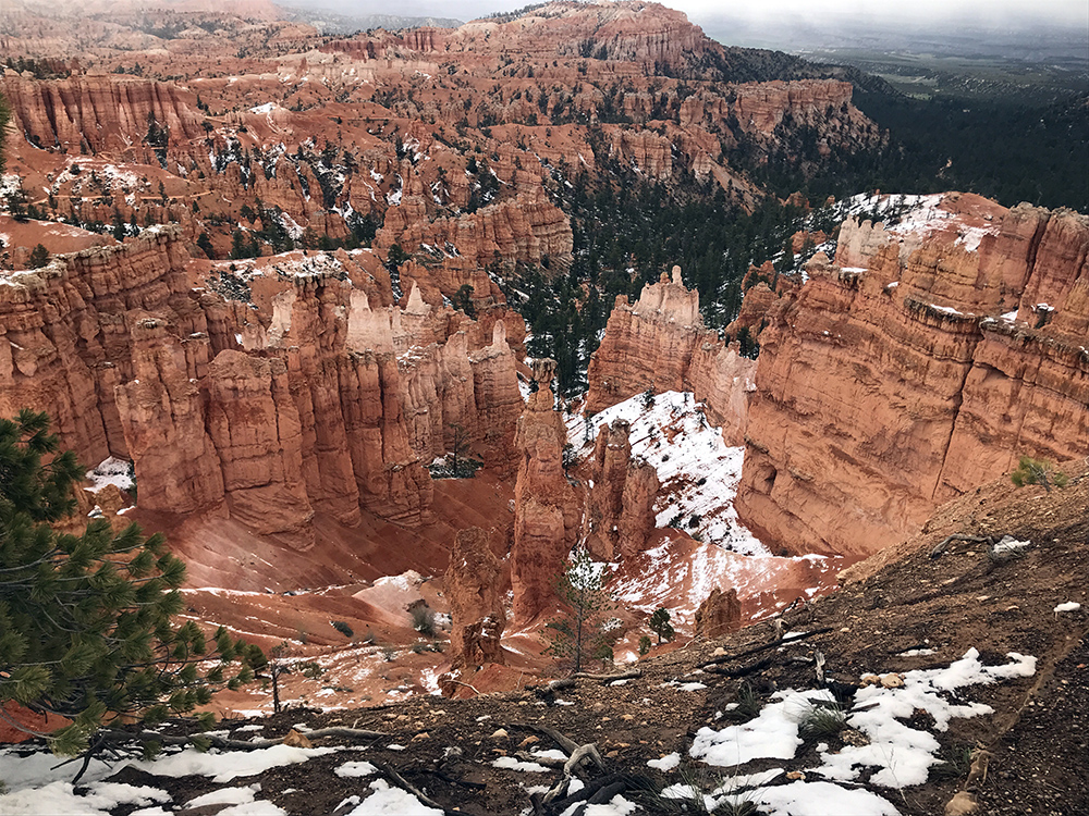
- Capitol Reef National Park: Fruita Schoolhouse At the bottom of a crumbling cliff wall is where I'd want to build a schoolhouse, personally.
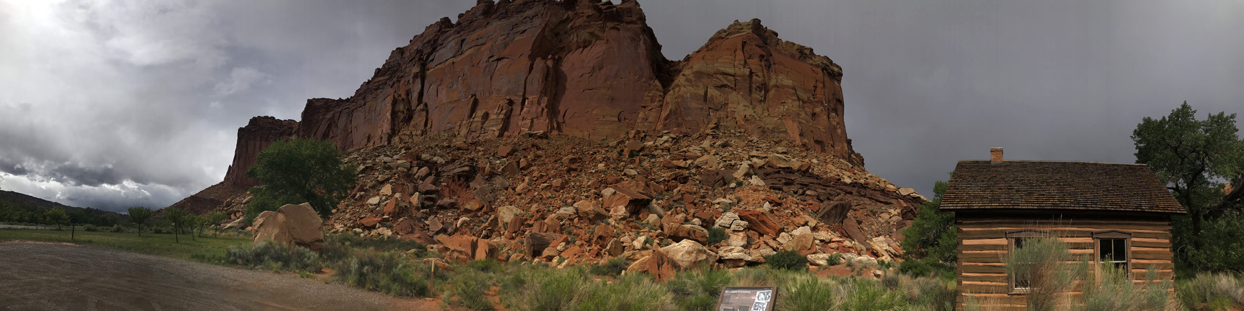
- Capitol Reef National Park: Petroglyphs
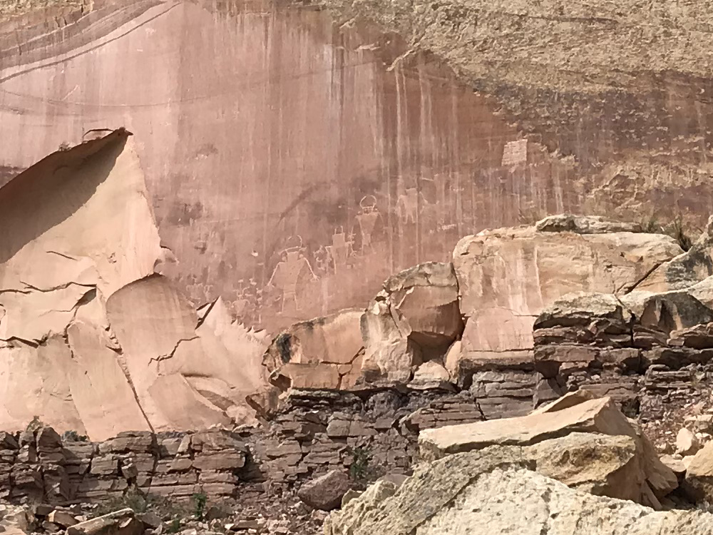
- Capitol Reef National Park: Capitol Dome
- Capitol Reef National Park: Thompson Mesa The picture doesn't do this scene justice. This was a staggering view in person, like something straight out of a science fiction movie.
- Kathline Rock These stand alone about halfway between Capitol Reef National Park and Green River, Utah.
- Storms on the Left, Sunshine on the Right On Route 24 towards Green River, Utah, there were black clouds in the west and sunshine in the east. The west caught-up with me by the time I got to Green River.
- A Growing Collection of Pins
Video Gallery
- Zion National Park: Through Zion-Mount Carmel Tunnel into Zion Canyon View Location Driving through the Zion-Mount Carmel Tunnel and down into the main canyon area.
- Zion National Park: The East Temple View Location A panning shot of The East Temple area from a stopping point on the Zion-Mount Carmel Highway.
- Zion National Park: The East Temple View Location Shot from the Zion-Mount Carmel Highway, you see what I call "The Eye" which I believe on top of which is Canyon Overlook.
- Zion National Park: Hand-Held Panning While Waiting View Location While waiting for the tunnel on the way out of the park, I took a quick panning shot of the East Temple area.
- Zion National Park: Leaving The Park View Location Just some hand held shots through my moon roof as I drove out of the park.
- Dixie National Forest: Red Canyon View Location I drove through Red Canyon on the way to Bryce Canyon National Park a week ago. It's actually quite far away from Bryce Canyon itself, but it shares its red/orange rocks and hoodoos, which you can see a bit of in this footage.
- Bryce Canyon National Park: Bryce Point Timelapse View Location The orange/pink canyon walls and the hoodoos are impressive. I only wish I'd gotten a little more sunlight on them than I did, but this is as good as it got for me today.
- Bryce Canyon National Park: Bryce Point View Location
- Bryce Canyon National Park: Sunset Point / Thors Hammer View Location I believe that Thor's Hammer is right in the middle of the shot at the beginning of the video, but it's honestly hard to make it out because everything looks the same color. My guess is that it's more impressive to look at from a different vantage point. I'd planned on hiking the path down below, but the weather had shut down the trails.
- Capitol Reef National Park: Thompson Mesa View Location This was one of the more epic views I encountered on my trip. Unfortunately, the weather was overcast and my equipment couldn't do it any kind of justice. Like many parts of Utah, I felt like a space ship could descend from the sky and I wouldn't think anything of it. It's all so weirdly beautiful.
- Caineville Badlands View Location This hand held footage taken through my moon roof shows a bit of the Caineville Badlands, which include a distinctive grey/black section to them. The colors in this area are all muted with lots of grey and browns. I hope to return some day and see what it all looks like lit-up by the sun.
- Kathline Rock View Location Kathline Rock is about 7 or 8 miles north of Hanksville, Utah, on Route 24. There isn't anything much taller than a tumbleweed for miles around, so it really sticks-out.
Places Visited
- Zion National Park
- Bryce Canyon National Park
- Capitol Reef National Park
© 2026 0degreesK