What To Do Today?
During my drive into Grand Junction, I called a friend who was familiar with Colorado and asked him for any suggestions in the area. He told me that Colorado National Monument (CNM) was essentially in Grand Junction, so that was a no brainer. Besides that, the only thing I knew was that I would end the day hitting Zion National Park (ZNP) on my way to St. George, Utah. So, while I was eating a banana from the complimentary breakfast (it’s seriously impossible to get a decent vegetarian option without dairy at these things), I checked-out a few brochures from the lobby for anything I could hit between CNM and ZNP.
Look at All The National Parks in Utah!
As I write this, I wonder why I didn’t look into what else was in Utah before leaving on my trip, because it would have made this day a little easier. The number of National Parks in southern Utah is remarkable and I was excited to find that there were two, essentially right next to each other, within striking distance from my route to St. George: Canyonlands National Park and Arches National Park. Upon visiting their respective websites, I was confronted with warnings about how popular the parks were and that long waits should be expected, but I didn’t pay them much attention. Memorial Day was three weeks away, so I figured it wouldn’t be a problem for me. Unlike the previous morning, my car was literally parked right outside the door to my room, which allowed me to quickly pack and get on my way.
Colorado National Monument
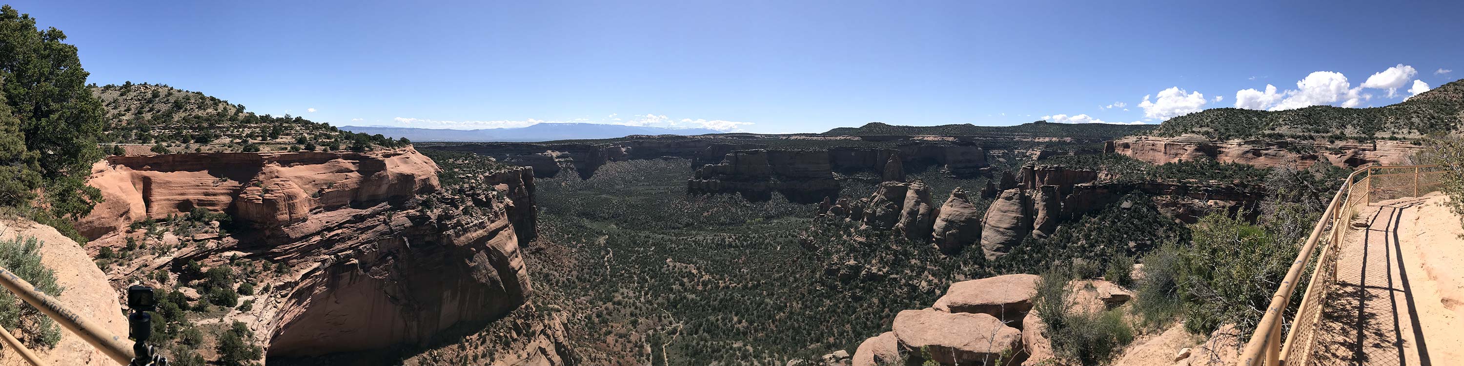
CNM is basically in Grand Junction, Colorado. The ranger told me it would take about an hour to drive through. The drive along the edges of the canyons was equally breath-taking and nerve-wracking. There were parts where I don’t remember there being anything significant between myself and the drop down hundreds of feet. Along the way there were numerous spots to park and take a look, but I don’t remember stopping at any besides the Coke Ovens Overlook where I captured a time lapse panning shot. A few of the people passing by were interested in my rig and I enjoyed discussing it with them. On the way out, I luckily found a place to quickly park at the visitor center so I could buy a pin and then I was off to Arches National Park.
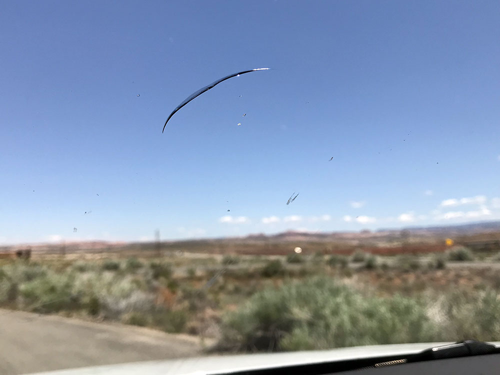
Note: As I got onto Route 340 toward Fruita, I got something which cracked my windshield. It instantly infuriated me, but I calmed down just as fast. Nothing was going to dampen my spirits on this day.
Entering Utah
Many friends had told me about Utah. CNM and the terrain on the way to the Utah border felt like it had given me an idea of what was to come, but nothing could have prepared me for it. While the border between Colorado and Utah is an imaginary line, it might as well be forged in stone because as I crossed that imaginary line it felt like I was swimming into the deep end of the pool where you can see the floor dropping out from under you. Mysterious… foreboding… epic! While many of the features in the terrain were familiar to me from the previous couple of days (e.g., buttes, plateaus, canyons), the ones in Utah were 10x as grand. It truly made me feel tiny.
Arches and Canyonlands
My original plan was to take a side road to Arches using Route 128 to Moab. When I got onto Route 128, I turned tail right away because it didn’t look like a significant path that I could rely upon. Back on Route 70 I then took Route 191 south towards the two parks. It didn’t seem like there was a ton of traffic. I was feeling optimistic.
As I passed the juncture of Routes 191 and 313, I noticed a sign for the local radio station broadcasting information on traffic for the parks. This isn’t something I usually pay attention to, but I decided to give it a shot. Now, keep in mind it’s around 1 PM on a beautiful Saturday morning. What I heard from the looping message on the radio station immediately brought me back down to earth. It informed me that both parks, Arches and Canyonlands, were severely overcrowded and that they were turning away cars at the entrances.
The news honestly didn’t do anything to my mood. Visiting the parks hadn’t been anything I’d even been aware of more than a few hours ago, so I just figured, “Next time.” The fact of the matter is that in that very moment I began to consider changing my plans for the trip and think about returning home through Utah rather than through the south.
Monitor and Merrimac
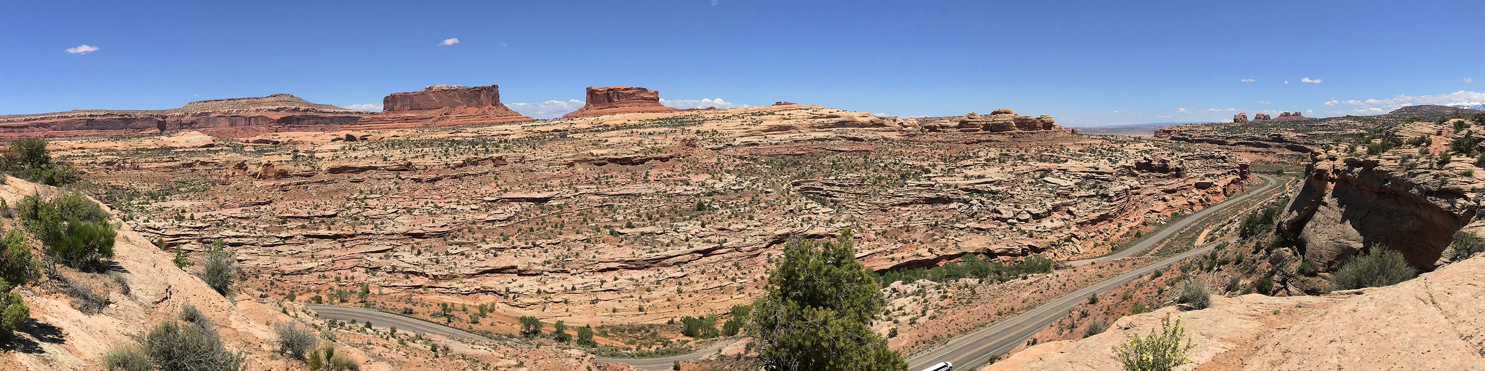
Given that my plans just opened-up and I wasn’t going to be spending two hours hitting both parks, I decided to just drive around the area a little bit. This is how I found the two buttes Monitor and Merrimac. Despite the fact that everything is interesting in this area, these two features really stick out. After a bit of a winding road, I found a scenic viewing stop and got out to get a better view of the buttes and take a nice time lapse video. The spot I hiked to was a out of the way and hovering high over the road I traveled to get there. It provided a great view of Monitor and Merrimac. As I waited for the shot to finish, I remember nervously looking around for snakes and seeing them all over the place, even though they weren’t there.
The San Rafael Swell
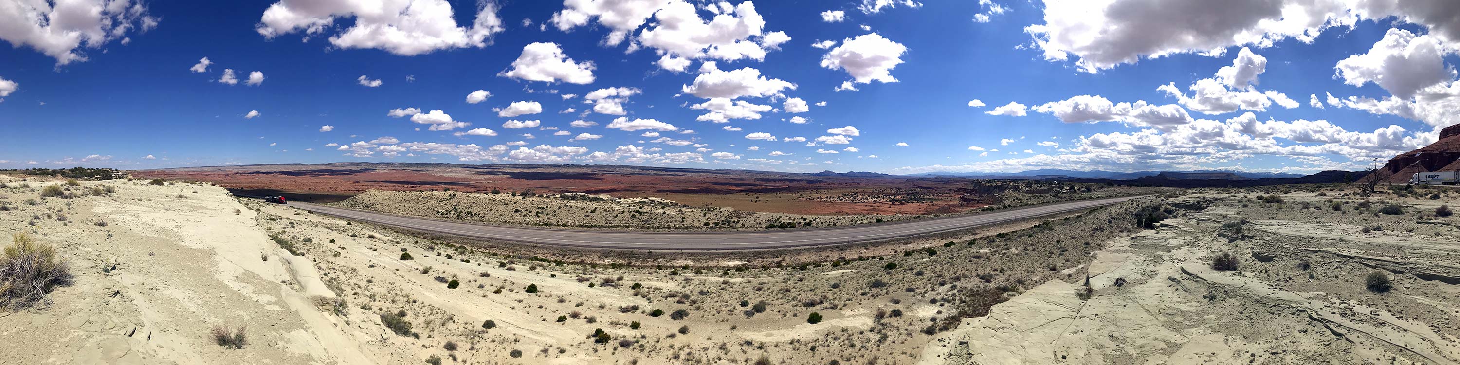
Shortly after a passing Grand River, Utah, I encountered what was arguably the most stunning moment of my trip. There is a place called the San Rafael Swell View Area where you can stop, and when you leave this place you will pass through what feels like a grand doorway. After a little winding, you will begin to descend and that’s when you enter a massive, red valley. For me, I felt like I was in a space ship, descending from the sky into an alien landscape below. It was astoundingly beautiful and horrifying and epic and wondrous all at the same time. I stopped at the Salt Wash View Area and must have spent an hour taking time lapse video and just taking in the view. As I returned to my car, there was a burly motorcycle guy taking a picture on his phone, and I made the remark, “It’s really something, isn’t it?” He simply looked over the top of his phone and replied, “It’s so beautiful…” and I swear there were tears in his eyes.
Bryce Canyon and Zion National Parks
Now, I wanted to stop through both Bryce Canyon and Zion National Parks on my way to St. George, Utah. My original plan for the day was to take as many back roads as possible, figuring driving Routes 70 and 89 would be boring, but I was mistaken. Even driving the main highways through this area is an amazing experience. That being said, I was making lots of stops and time was crunching on me. The drive through Red Canyon in Dixie National Forest, on the way to Bryce Canyon National Park, was beautiful. Even though I felt ashamed doing it, I drove into Bryce Canyon National Park, bought a pin at the visitor center and left. At that point, Zion National Park was closed (though in my ignorance I’d have never made it to the visitor center even if it had been open), so I made my way directly to St. George, Utah.
Along the way, there were some memorable moments. The first was a rainbow that appeared to travel along with me outside the driver side window. It was dip down from the clouds, then disappear, then pop back out. After that, everything got extremely cold and then there was snow everywhere. Somehow I had driven up into an altitude that supported snow and I hadn’t even realized it. Finally, coming down from those heights, I drove into Last Chance Canyon as the sun was setting and the view rivaled the San Rafael Sweep that I described earlier. The entire side of the cliff was on fire from the setting sun and it towered overhead.
End of the Day
After a few days of trail mix and canned soup, all I wanted was some fresh vegetables, but I wanted to eat before 8 PM because I was trying to avoid an upset stomach. There was a restaurant just past Last Chance Canyon and I decided to give it a shot. After sitting down, it only took a moment to realize they had nothing for me, no salads or anything. It was a bit infuriating only because I wasted about a half-hour stopping, securing my car, sitting down only to realize it was a failure.
The motel in St. George was luxurious but noisy. After moving in and eating another can of soup, I got everything downloaded and archived, then laid myself down to sleep. It was hard to believe that I’d be in San Diego in less than 24 hours.
Image Gallery
- Close Parking After having about a 1/4 mile round trip up and down a flight of stairs the previous night, it was nice to be able to park right outside my room.
- Directions This is how prepared I was for this trip. While eating breakfast and glancing through a Utah tourists guide I grabbed in the motel entrance, I jotted-down some basic directions allowing me to hit: Arches, Canyonlands, Bryce Canyon and Zion in a single day. The innocence of youth!
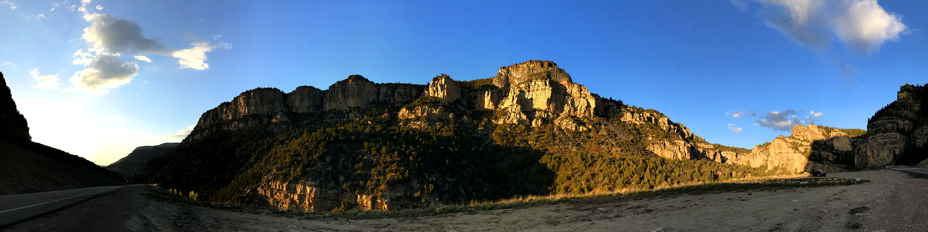
- Coke Ovens Overlook (Colorado National Monument) Colorado National Monument was a nice introduction to the land of canyons I was entering this day. The trip through the park closely hugs the canyons edges. Had my nerves tingling.
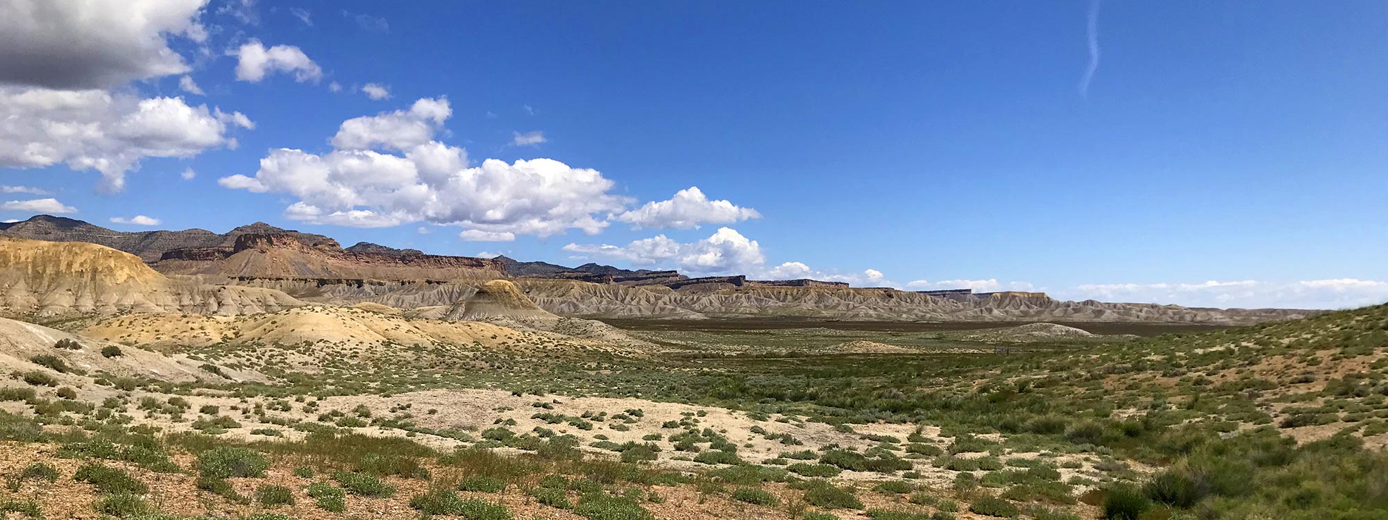
- Utah Welcome Center Not that this view wasn't worth stopping to take a picture or two, but I learned this day that if you stopped to take pictures of every picture-worthy scene in Utah, you'd need a lifetime to get through the state.
- Monitor and Merrimac After discovering that Arches and Canyonlands were over capacity, I decided to simply drive around the area and look around. I took this picture before I even knew these buttes had names.
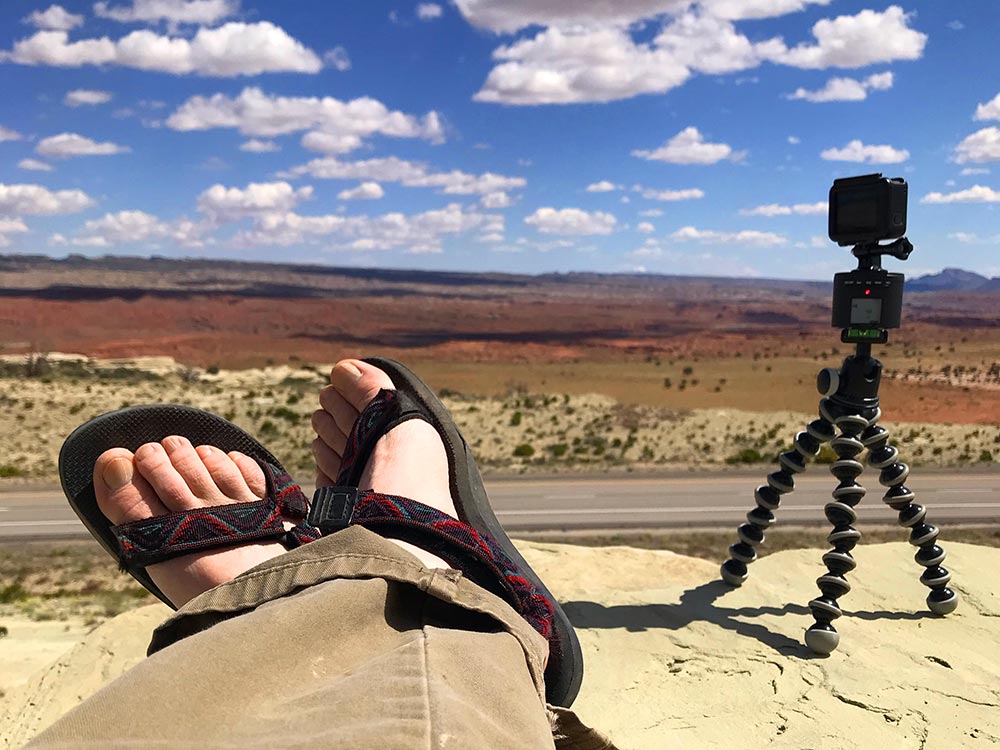
- Timelapse My traveling companion hard at work while I take in the view and the sunshine.
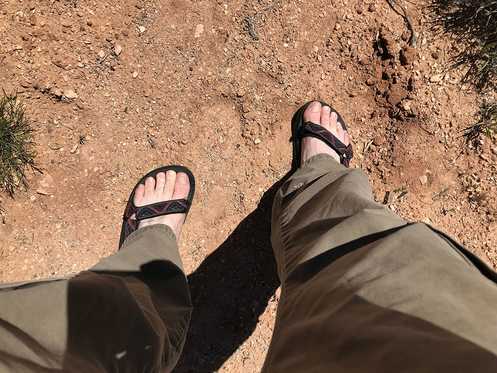
- Sandals?!? If you know me, you know that I don't wear shorts or sandals UNLESS they're warranted. As far as I'm concerned, sandals are only appropriate on a man's feet when there is sand to walk on.
- Glamour Shot At the intersection of routes 191 and 313 in western Utah, between Canyonlands and Arches National Parks.
- Cracked Windshield Picked this up immediately upon exiting Colorado National Monument this morning.
- San Rafael Swell View Area This was a spectacular view, but the mind-blowing stuff was a few miles down the route through that pass on the left.
- San Rafael Swell Looking back on my trip, I would have to pin the gold star on this for the most beautifully breath-taking moment of the trip.
- Timelapse, sandals... and a sun burn When I looked in the mirror of my hotel room in St. George, Utah, later this evening, I was horrified by the deep red hue of my face. I just didn't want to leave this moment.
- Red Canyon You pass through Red Canyon in Dixie National Forest on the way to Bryce Canyon. I didn't make it into Bryce Canyon today, but I'd be back.
- Rainbow Cloud It's hard to see in this picture, but there's a rainbow dipping down to the right from the cloud in the middle of the picture. It followed along with me for a few miles like this.
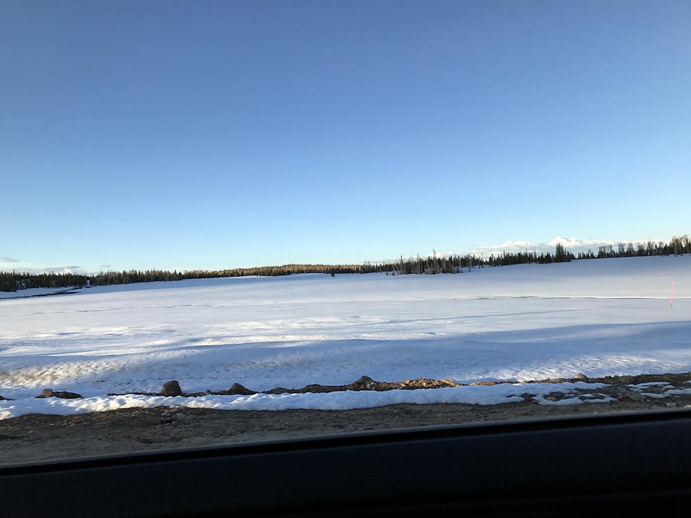
- (Frozen) Navajo Lake How in the hell am I freezing my ass off and surrounded by snow?!? I hardly noticed that I'd ascended or crossed some kind of border to allow this.
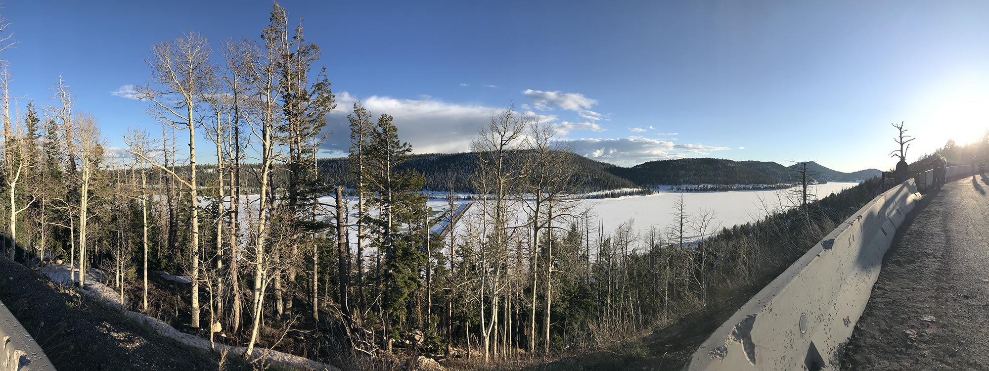
- Cedar Breaks Snow It was seriously still winter up here.
- Entering Last Chance Canyon A few miles outside of Cedar City, Utah, on Route 14, I caught the sun setting off the side of this canyon. There was nobody around, so I stopped in the middle of the road to take this picture, but there was a better one coming.
- Last Chance Canyon at Sunset While I probably ran into the most beautiful moment of my trip earlier in this day, this one was a close second. As always, the picture can't do it justice. It was truly majestic and made me feel appropriately small and insignificant.
Video Gallery
- Coke Evans Overlook (Colorado National Monument) View Location This bit is exemplary of Colorado National Monument. There are numerous stops along the way to get out and sit on the edge of the canyon. If you look closely, you'll notice a trail leading out through the middle of the canyon below. The trailhead was somewhere around where this video was shot.
- Entering Utah through Moonroof View Location When I began my trip, I planned on shooting each border crossing, but I forgot all about the idea once I discovered there were more interesting things than border signs.
- Monitor and Merrimack (Route 313, Utah) View Location These two buttes get their names due to their resemblance to the ironclad ships from the Civil War.
- Monitor and Merrimack Surroundings (Route 313, Utah) View Location This clip gives you an idea of where I was shooting from. Right below are the switch backs on Route 313 leading-up to the viewing area. Canyonlands National Park is off to the west (left) and Arches National Park is to the southeast (right and behind).
- San Rafael Swell (Sand Bench View Area, Utah) View Location This was arguably the most beautiful view from my entire trip. The vastness of Utah blew me away, and the red sands combined with the blue skies and passing clouds were amazing.
- Red Canyon (Driving Toward Bryce Canyon National Park) View Location Red Canyon is in Dixie National Park on the way to Bryce Canyon National Park.
- Last Chance Canyon (Just Outside Cedar City, Utah) View Location By the time I encountered Last Chance Canyon, I was about three hours behind schedule and just wanted to get to my motel room and fall asleep. This view challenged the San Rafael Swell area in beauty, but I just couldn't bring myself to set-up for a 15-20 minute time lapse shot and settled for this quick capture.
Places Visited
- Colorado National Monument
© 2026 0degreesK